William M. Dowd photos
GLOUCESTER, MA -- It could have been called Cape Tragabigzanda. In fact, it once was.
Much of it remains rural, with salt marshes and small rivers everywhere. Gulls swoop about, and herons suddenly soar up from the grasses, startling a visitor and at the same time providing a perfect photo opportunity.
It is a place also dotted by stands of sturdy oak, far fewer in number than centuries ago but a reminder of what helped attract European settlers eager to establish communities and construct sailing ships to ply the cold waters of the Atlantic that lap up on the shores of three sides of this jut of land.
Its largest community is home to barely 32,000 souls, and many of the little neighboring towns and villages seem to be suspended in time, periodically awakening like Brigadoon, albeit once a year rather than once every hundred.
Welcome to Cape Ann, Massachusetts' "other cape.''
That's not a description locals tend to appreciate. While Cape Cod has far wider fame, Cape Ann has plenty to distinguish it, they will point out. Each of its main communities has its own pedigree.
Gloucester, its main city, is the nation's oldest fishing port, founded in 1623. Tiny Rockport, a city of less than 8,000, once was the granite mining center of the eastern seaboard, supplying building materials to cities and towns booming from the Industrial Revolution. Even tinier Manchester-by-the-Sea, 5,200 population, was settled in 1629 and became Boston high society's summer coast of choice after the distinguished poet Richard Dana built a seasonal home there in 1845. And, Essex, tinier still at 3,200, was a renowned shipbuilding center that supplied the maritime industry with fleet wooden schooners.
Cape Ann was named for Queen Anne of England after earlier attempts at naming it. The French explorer Samuel de Champlain briefly came ashore here, then, in 1606, made a return visit and a peaceful encounter with the 200 or so Agawam Indians who inhabited the area. He referred to it as Le Beau Port. The English explorer John Smith, who early in his life was held captive by the Turks, later fancifully renamed the New World land Cape Tragabigzanda after a Turkish princess. King Charles settled the matter when he named it after his mother, although it soon became spelled without the "e.''
But that was then. Now, Cape Ann's major claim to fame is as a tourist destination, not only for denizens of the Boston area just a half-hour drive to the southwest, but for hundreds of thousands of others.
It also has periodically attracted moviemakers, from 1937 when much of the Spencer Tracy film "Captains Courageous'' was shot here to 1997 when the George Clooney film "The Perfect Storm'' was set, and shot, here.
 Sharp boulders dot the landscape of the Jones River Salt Marsh.
Road signs direct visitors coming from the south to several exits off Route 128 for Gloucester. Taking the one not mentioned, Exit 13, is a smart move.
It leads you to the Town Landing of the City of Gloucester, an oddly named place -- is it a city, or is it a town? -- that is an excellent spot for photographing or just gazing at the Jones River Salt Marsh.
The flat, rutted expanse is covered with marsh grasses and dotted with outcroppings of sharp boulders. It is a starkly beautiful part of the 17,000-acre Great Marsh that extends from Cape Ann northward into New Hampshire.
As the eye follows the curving sweep of the marsh toward the outskirts of Gloucester proper, it becomes obvious this is a community of the sea. Houses are built with window and deck views oriented toward the water, be it the Jones River, the Annisquam River, a broad marsh or Gloucester's deep water harbor.
All along the cape, broad, pristine beaches with fascinating names -- Wingaersheek Beach, Singing Beach, Chebacco Lake Beach -- are made for year-round strolling even if the non-summer months can be blustery and many of the shops and dining spots are open only seasonally.
Wingaersheek Beach, just up the road from the Town Landing, is a fine example of a beach for young and old alike. Although most of the dunes areas on Cape Ann are off limits to foot traffic due to a restoration project under way, large areas are good for sunbathing or strolling. Groupings of huge boulders and rocks smoothed off over millenia by the effects of the sea provide small sheltered nooks for beach chair loungers or imaginary fortresses to be climbed by nimble younger folk.
Back on Route 128, exit 15 takes you through Grant Circle, one of New England's iconic traffic rotaries, and into the city.
 Winding streets housing clusters of shops and dining spots are a common sight in downtown Gloucester.
 Gloucester, named for an English port city, is built on a slope that runs down to the waterfront and its famous harbor. That has made for some creative construction over its 384 years, with numerous winding streets and lots of tightly clustered small shops in the center of the city, yet a great openness by the water.
The oldest buildings tend to be of brick and granite, some of them survivors of two devastating fires -- one in 1830 that wiped out more than 70 structures, the other in 1864 when 103 buildings were destroyed.
On Stacy Boulevard, parallel to the shop-studded Main Street, visitors walk along the seawall or lounge on benches. The view toward the harbor is of busy ships making their ways back and forth. Or, of historic Ten Pound Island Lighthouse that sits at the end of a spit of land guarding the harbor entrance. The famous painter Homer Winslow (1836-1910) lived in rented quarters in the now-gone lightkeeper's house in the summer of 1880 and painted about 50 scenes of Gloucester Harbor.
In the middle of the pedestrian pathway is the famous "Man at the Wheel'' statue, the sailor steering his ship who is the dominant part of the Fishermen's Memorial Cenotaph installation dedicated, as the inscription from Psalm 107 on the statue says, to "They that go down to the sea in ships.'' Names of many mariners who died at sea are inscribed on stone installations there. A few yards away is another monument, this one to the wives and children of mariners.
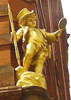
Those who are more into commercialism shouldn't miss another iconic figure on Rogers Street -- the Gorton's of Gloucester fisherman, clad in yellow slicker and rain hat. He's been the trademark of the 158-year-old seafood company for years.
Driving back to the Grant Circle rotary, take a right turn and pick up Route 127 into Rockport, a few minutes' drive away. It's a charming little spot with its own cape, a neighborhood called Bearskin Neck, that is jammed with arts and crafts dealers and artists, as well as numerous eateries including The Fish Shack, one of the better tourist town restaurants I've tried and with a nice view of the harbor.
It's not all shops and galleries, however, despite its diminutive size. The Rockport Chamber Music Festival's season, for example, runs from June 7 to July 1, featuring visiting professional musicians. And, in typical maritime Massachusetts tradition, whale watch boat tours are a regular offering.
Reversing course and getting back on Route 128, you'll head for Route 133 and Essex, not much more than a bend in the road but filled with antique shops and a smattering of art galleries.
For those who believe such things, the year-round restaurant called Woodman's at Essex, founded in 1914, claims to have invented the fried clam in 1916. The dish gets high praise from all around, thanks primarily to the local clams taken from along the Essex River that runs northward into Ipswich Bay.
Then it's over to adjoining Manchester-by-the-Sea. It was just Manchester until 1990. But, Manchester is such a common name in New England that railroad conductors had taken to calling it by the longer name to distinguish it from the others and town residents voted to make the name official.
It is the quietest of Cape Ann's four main communities, but has its share of shops and dining spots. It also has the Trask House Museum, which provides a glimse into 19th century New England artifacts, decorative arts and furniture. And, the town is the home of Singing Beach, so-called because the sand makes a squeaking sound when walked on.
Throughout the cape, you'll find any number of opportunities to get out on -- or even under -- the water, ranging from whale watching, deep sea fishing charters and pleasure cruises, boat rides on the Essex River and sailing on antique-design schooners to river kayaking and scuba or snorkel diving.
For those interested in whales, the Whale Center of New England, located in Gloucester, has the skeleton of a humpback whale on display. It also offers information from marine mammal experts on the population, behavior, and biology of marine mammals in local waters.
Although various events are staged in Gloucester throughout the year, the major one is the St. Peter's Fiesta, this year set for June 27-July 1. As is the case in numerous other seaports, the event was started by Italian-American fishermen. This one began in 1927 when fishing captain Savatore Favazza, a Sicilian immigrant, had a lifesize statue of St. Peter erected in the Italian district. Very quickly, a religious festival was organized around it, and in the next few years the event grew in scope and variety to include events on land and water.
Since it is far more compact than that "other cape,'' you can do Cape Ann justice in a shorter visit. Then again, as I mused over a hearty and inexpensive breakfast at The Gull restaurant in a Gloucester marina the morning I was to depart, what's the rush?
 The famous "Man at the Wheel" statue in Gloucester is dedicated to mariners who plied the waters off Gloucester.
 Huge rock groupings at Wingaersheek Beach provide shelter for adults and climbing opportunities for kids.
 The sand dunes at Wingaersheek Beach are off limits these days to strollers, due to a dune restoration project under way.
ON THE WEB
• Cape Ann Chamber of Commerce
• Cape Ann.com
• Rockport Chamber of Commerce
• Dive News
• Cape Ann Historical Museum
• Gloucester Harbor Web Cam
• Whale Center of Cape Ann
• Dowd's Guides


